Navigation bar#
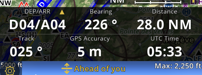
The Navigation bar at the bottom of the screen displays real-time navigation values. The number of values displayed, depends on the size of the screen. Long tap on the value you want to remove then select the value you want to replace.
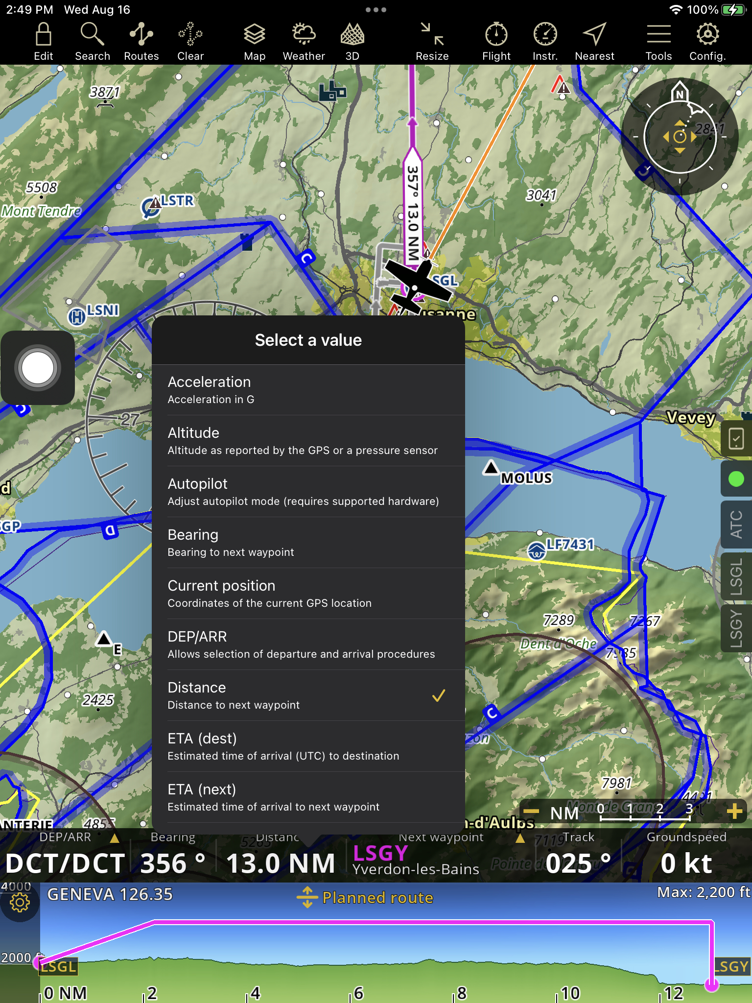
Acceleration
Altitude: Reported by the GPS or a pressure sensor. Tapping the Altitude in the navigation bar, displays the QNH Setup: Since the altitude of the barometer has to be corrected by the actual atmospheric pressure, the QNH can be changed in Air Navigation Pro. This will have an effect on the altitude display. The QNH is downloaded via the internet automatically as default, a message is displayed with a timestamp of when this information was downloaded last. You can also tap on the arrow to refresh the information manually. QNH can also be changed manually by disabling the Automatic setup first, then select from QNH selector. You can change the unit of the QNH under “Configuration - Settings - Units”.
Autopilot: Adjust autopilot mode (requires supported hardware)
Current position: Coordinates of the current GPS location. Tapping on the Current position will automatically create a user waypoint. A message will appear giving an option to edit the waypoint.
Flight time: Elapsed time since start of flight
GPS Accuracy: Accuracy of the GPS locaton in meters
Groundspeed: Speed relative to the ground
Height over ground
Track: GPS Track
UTC Time
Vertical Speed
If you previously planned a route, you will also find:
Bearing: Bearing to next waypoint
DEP/ARR: Allows selection of departure and arrival procedures
Distance: Distance to the next waypoint
ETA (dest): Estimated time of arrival(UTC) to destination
ETA (next): Estimated time of arrival to next waypoint
ETE (dest): Estimated Enroute time to destination (mm:ss)
ETE (next): Estimated time enroute yo next waypoint (mm:ss)
Next waypoint: Identifier and name of the next waypoint
Tablets#

Phones#